A series of maps will be presented in order to understand the final map of all trailheads. The order is:
The general vicinity of the Angeles National Forest is shown in the following map from Vicinity Corporation. The cross is near the Angeles Crest Highway (SR2), the main road through the ANF heading northeast from above the "a" in "Pasadena". SR39 is the road just to the east that no longer meets SR2 due to a massive landslide. Note the surrounding roads to compare with my maps below.
The following map shows just the roads within and around the ANF. The roads have been digitized by me from the USGS maps, and so don't follow every nuance of each road. I've only plotted the minor roads which lead to trailheads. In some cases, the minor road continues on past the trailhead shown.
The axes are north latitude and west longitude in degrees. Note that USGS maps for the U.S. plot east longitude which is (360° - west longitude). I use west longitude so that my spreadsheet would plot the roads with west on the left.
The map is not a true-scale map since north-south distances are slightly different from east-west distances. One tic mark (0.1°) of latitude is 11 km = 6.9 miles, and one tick mark (0.2°) of longitude is 18 km = 11.5 miles. Since the tick marks span 56 pixels in latitude and 73 pixels in longitude, the scales are 0.12 miles per pixel in latitude and 0.16 in longitude. The difference in scales is thus about 25%.
I will post the digital data for all plotted items separately soon for those who would like to have them.
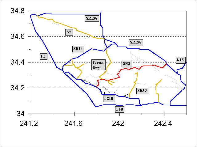
| Symbol | Item |
|---|---|
| Blue Lines | Peripheral Roads and Freeways |
| Red line | Angeles Crest Highway |
| Greenish curvy lines | Major Forest Roads |
| Light gray lines | Minor Forest Roads |
| Black lines | City streets |
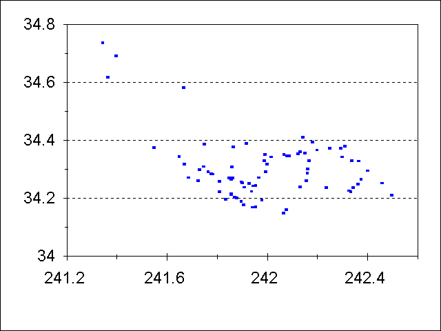
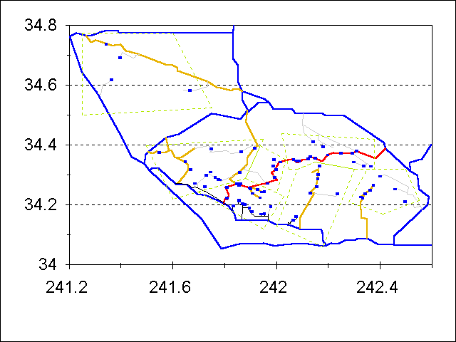
The following map shows just the trailheads for hikes in the ANF. As you might imagine, they mostly follow the major roads and the foothill locations next to civilization.
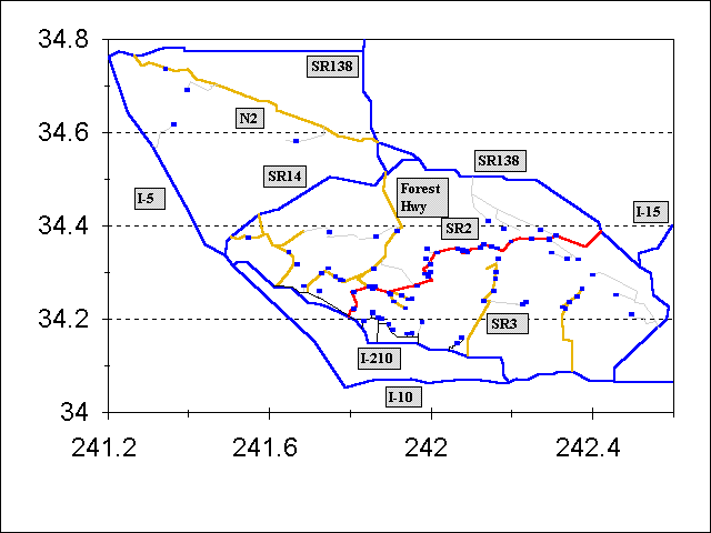
Now let's put the trailheads on top of the roads (or more precisely, at the ends of a lot of the roads):
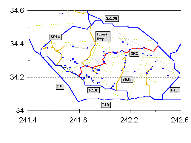
Now let's superimpose the hiking regions and make the map clickable so that a click within any hiking region will take you to those hikes in that region. Look at the browser status bar at the bottom of your screen to see what area your mouse is over.
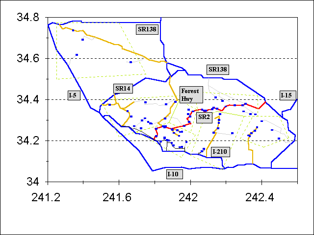
Map legend:
| Symbol | Item |
|---|---|
| Greenish polygons | Trailhead area definitions |
| Small blue crosses | Trailheads |
| Blue Lines | Peripheral Roads and Freeways |
| Red line | Angeles Crest Highway |
| Greenish curvy lines | Major Forest Roads |
| Light gray lines | Minor Forest Roads |
| Black lines | City streets |
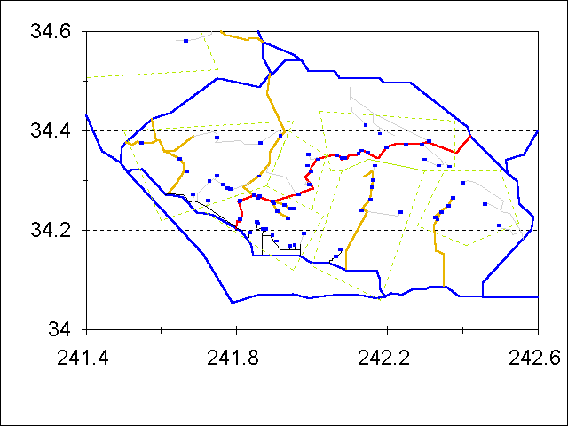
This map can be made less cluttered by removing the labels, but is now useable only by those who know the region from the previous map:
In order to see the detail better in most of the ANF, the following map excises the trailheads for the few hikes in the northwest ANF, but leaves in that clickable region to allow those hikes to still be reached.
And finally, the labels can be removed from this map as well:
With a less-cluttered map, I can plot some other interesting things, like the locations of waterfalls and of sites with remaining wreckage from airplane crashes (thanks to Chris Killian). Waterfall locations are represented by filled small blue-green triangles, and the crash sites are represented by small green open squares.
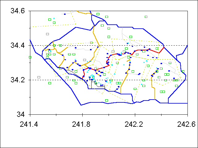
I've also made a plot of all the waterfalls and crash sites with labels in the entire ANF. The waterfalls and crash sites are shown in each of the hiking region plots as well, where they can be seen much better.
Go To:
Copyright © 1997-1999 by Tom Chester.
Permission is freely granted to reproduce any or all of this page as long as credit is given to me at this source:
http://la.znet.com/~schester/angeles_mtns/regions/hike_locations_tutorial.html
Comments and feedback: Tom Chester
Last update: 4 November 1999.