Directions to Borrego Springs, CA, and the Anza-Borrego Desert. Website, maps and photos, (unless otherwise noted) by Kat Gibson, POB 147, Borrego Springs, California 92004. All Rights Reserved. 03/22/2006
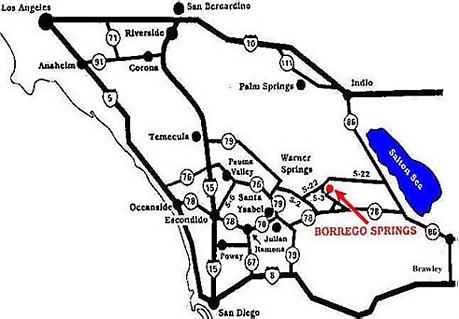
From Palm Springs
Take Highway 111 South to Highway 86 South past the Salton City area to Country Road S22.
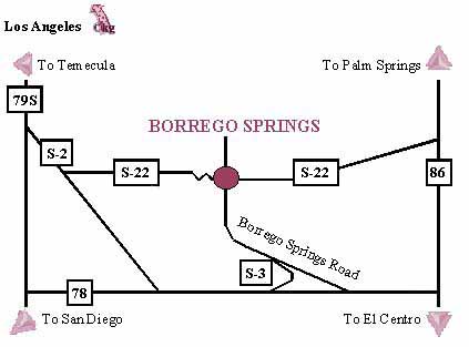
Take S22 West (Borrego Salton Seaway) for 28 miles to Christmas Circle (downtown Borrego)
From Brawley
Take Highway 86 to Highway 78 West
Proceed on Highway 78 through Ocotillo Wells to San Diego County Road S3 (Borrego Springs
Road)
Continue on S3 all the way into Borrego Springs
From San Diego
Take Interstate 8 East to Highway 67 North.
Proceed on Highway 67 North through Ramona (Highway 67 becomes Highway 78 East).
Take Highway 78 East to Highway 79 North at Santa Ysabel.
Take Highway 79 North to San Diego County Road S2 (San Felipe Road).
Proceed on County Road S2 to San Diego County Road S22 (Montezuma Valley Road).
Take S22 through Ranchita to Palm Canyon Drive and downtown Borrego Springs, California.
From Temecula
From Interstate 15 take Highway 79 East through Warner Springs
Take Sandiego County Road S2 to San Diego County Road S22 (Montezuma Valley Road).
Take S22 through Ranchita to Palm Canyon Drive.
Back to Anza-Borrego Desert Resources
Intellectual Property Rights enforced.